 Source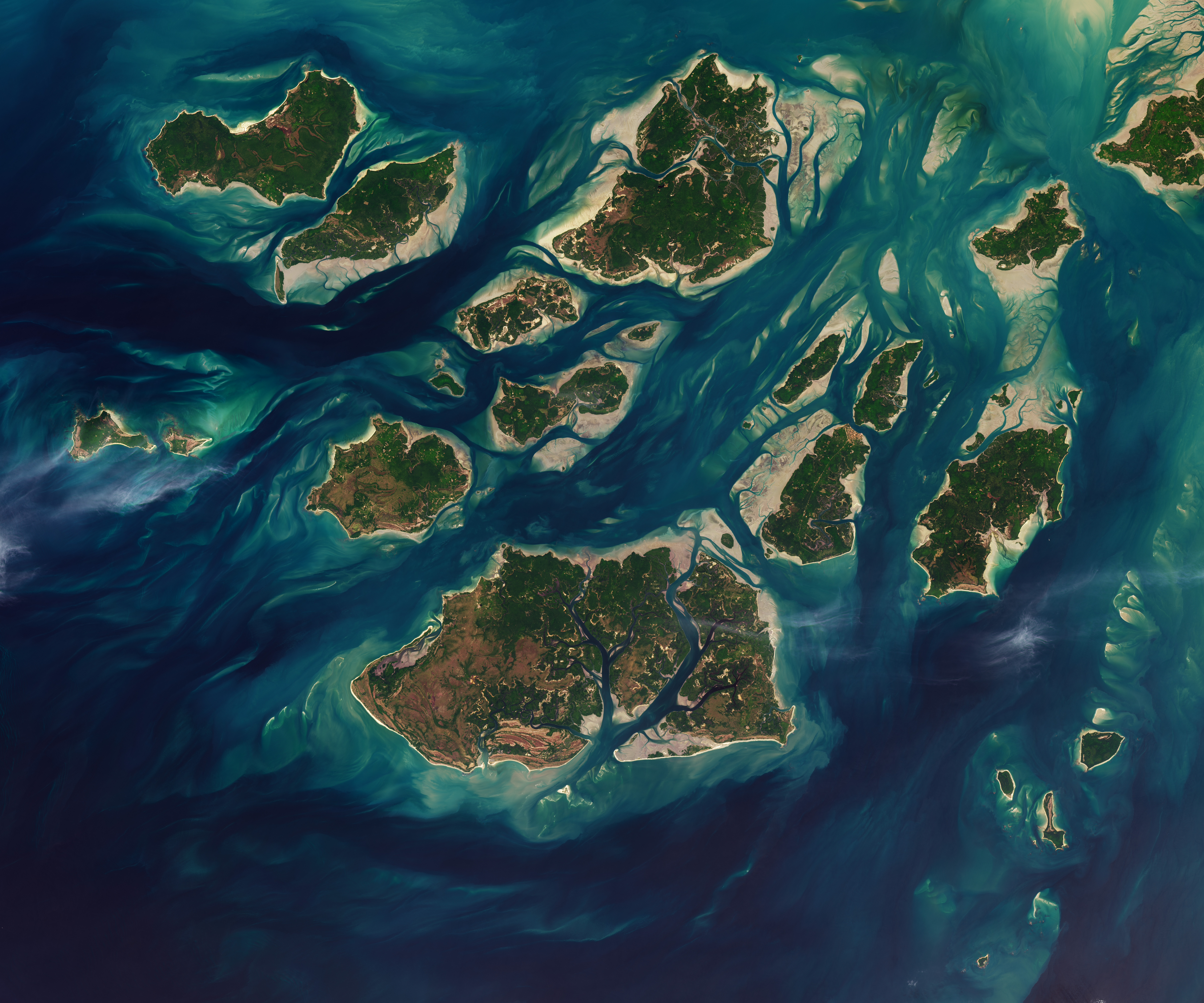
Guinea-Bissau Tidal Waters
Tides in Guinea-Bissau's Bijagós Archipelago cause its islands and islets to expand and shrink twice daily.
Why it matters
The shifting landmasses affect the archipelago's environmental characteristics and how its waters are navigated.
The details
- The Bijagós Archipelago consists of 88 islands and islets.
- Mudflats and sandflats emerge from the sea during low tide.
- NASA imagery captured this process on Nov. 28, 2025.
Show entities and relationshipsHide entities and relationships
In this article
Countries
Key connections
Collaborated on satellite imagery of Guinea-Bissau's Bijagós Archipelago
NASA is related to Guinea-Bissau
NASA captured and published satellite imagery of Guinea-Bissau's Bijagós Archipelago tidal waters
USGS is related to Guinea-Bissau
USGS credited alongside NASA for satellite imagery of Guinea-Bissau
Related events
Aug 3, 2026•28d ago
•Earth ObservationNASA Publishes Earth Observatory Image of Guinea-Bissau Tidal Waters
Get the weekly recap
The stories like this one, picked and explained — once a week, straight to your inbox.