 Source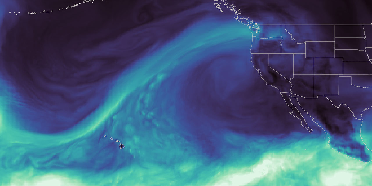
NASA Data Feeds River Forecasts as Snow Drought Effects Linger
NASA satellite data is feeding machine-learning forecasts to help water managers predict river flow and manage resources during extreme weather in the western United States.
Why it matters
These predictions allow utilities like Tacoma Power to maintain reliable electricity for over 151,000 homes while managing public safety during floods and droughts.
The details
- Tacoma Power uses HydroForecast to predict river flow from hours to days ahead.
- Winter 2025-26 saw record low Western snow cover in January, February, and March.
- NASA became a formal partner of the U.S. Drought Monitor in 2026.
Show entities and relationshipsHide entities and relationships
In this article
Topics
Products
Organizations
Technologies
Countries
Companies
Key connections
Upstream Tech owns HydroForecast
Upstream Tech develops and operates the HydroForecast river-flow forecasting platform
NASA owns Moderate Resolution Imaging Spectroradiometer (MODIS)
NASA operates the MODIS instruments aboard Terra and Aqua satellites
NASA owns Visible Infrared Imaging Radiometer Suite (VIIRS)
NASA produces data products from the VIIRS instrument
NASA owns Suomi National Polar-orbiting Partnership (Suomi-NPP)
NASA operates the Suomi-NPP satellite in partnership with NOAA
NASA is related to U.S. Drought Monitor
NASA became a formal partner in 2026 helping produce and author the weekly U.S. Drought Monitor
Saul Villarreal works at Tacoma Power
Saul Villarreal serves as senior hydro operations manager at Tacoma Power
Show 16 more connectionsShow fewer connections
Laura Read works at Upstream Tech
Dr. Laura Read is director of technical and federal partnerships for HydroForecast at Upstream Tech
Tacoma Power uses HydroForecast
Tacoma Power uses HydroForecast predictions to manage reservoir operations and hydropower on the Cowlitz River
HydroForecast uses Visible Infrared Imaging Radiometer Suite (VIIRS)
HydroForecast collects and uses NASA VIIRS observations of snow cover and vegetation conditions
HydroForecast uses Moderate Resolution Imaging Spectroradiometer (MODIS)
HydroForecast uses NASA MODIS satellite data records to train forecasting models
HydroForecast is built with Machine Learning
HydroForecast employs machine learning to model how water moves through watersheds
Visible Infrared Imaging Radiometer Suite (VIIRS) is related to Suomi National Polar-orbiting Partnership (Suomi-NPP)
The VIIRS instrument is hosted aboard the Suomi-NPP satellite
Visible Infrared Imaging Radiometer Suite (VIIRS) is built with Satellite Remote Sensing
VIIRS is an optical and infrared sensor applying satellite remote sensing technology
Goddard Earth Observing System (GEOS) is built with Satellite Remote Sensing
GEOS incorporates satellite remote sensing data to model Earth system and atmospheric river events
Natural Resources Conservation Service is a partner of NASA
NRCS partnered with NASA to incorporate satellite-based snow and groundwater data into water-supply forecasts
Natural Resources Conservation Service uses Machine Learning
NRCS uses machine-learning water-supply forecasts integrating satellite data
Colorado Basin River Forecast Center uses Moderate Resolution Imaging Spectroradiometer (MODIS)
The Colorado Basin River Forecast Center uses MODIS data to adjust snowmelt rates in its hydrological model
Colorado Basin River Forecast Center uses Visible Infrared Imaging Radiometer Suite (VIIRS)
The Colorado Basin River Forecast Center uses VIIRS data to adjust snowmelt rates in its hydrological model
Bureau of Reclamation uses Visible Infrared Imaging Radiometer Suite (VIIRS)
Bureau of Reclamation uses NASA VIIRS and snow data for reservoir operations in the San Joaquin Basin
Upstream Tech is located in United States
Upstream Tech is a technology company based in the United States
Tacoma Power is located in United States
Tacoma Power is a public electric utility in Washington state, United States
NASA owns Goddard Earth Observing System (GEOS)
NASA developed and operates the GEOS global Earth system model.
Related events
NASA Expands Role and Authors U.S. Drought Monitor Assessment
Tacoma Power Manages Cowlitz River Extremes with NASA-Informed HydroForecast
Upstream Tech Integrates NASA Satellite Data into HydroForecast
Get the weekly recap
The stories like this one, picked and explained — once a week, straight to your inbox.